Auction History
Auction has finished
Auction failed because there were no bids| September 20, 2024 12:00 am | Auction started | ||
The Vendor
- Vendor: ArnoldAuctions
- No ratings found yet!
-
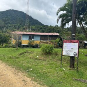
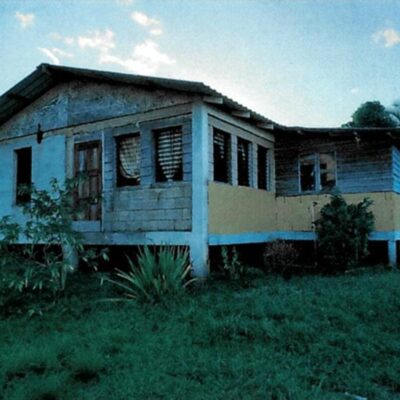
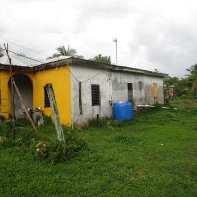
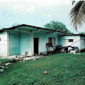
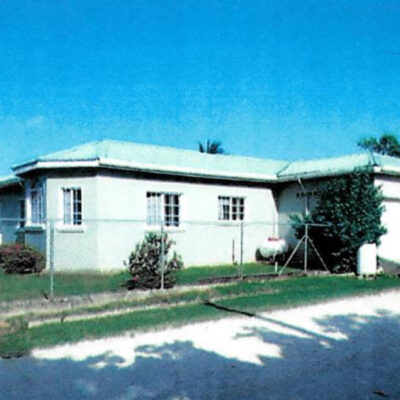
Lot No.-184 attached to Plan No.-2146 situated in St. Matthews Village, Cayo District – LICU
Auction EndedLot No.-184 attached to Plan No.-2146 Deed of Conveyance LTU-201501474 situated in the St. Matthews Village, Cayo District, and registered at the Lands and Surveys Department in Belmopan, as Lot No. 184 on Plan No. 2146 – being thereon, the Deed of Conveyance of Miriam Janet Quevedo for Abner Jonathan Quevedo.
The property is located in developing and populated area of the village which is close proximity to schools and highway. It has 1 bungalow wooden wall structure.
-
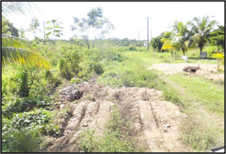
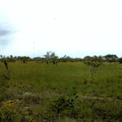
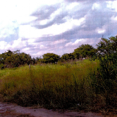
Parcel No. 1311, Block 4, Carmelita, Orange Walk District – LICU
Auction EndedProperty Details: ALL THAT piece or parcel of land being Parcel No.1311, Block 4 situated in the Carmelita Registration Section, Orange Walk District containing 1042.9 S.M., and held under a Land Certificate and being thereon, the freehold property of Vanina Tasha Marchand.
Description: This parcel of land is an empty lot and the property is located on the outskirts of the Carmelita Village immediately beside the Smart Tower. It is a block away from the Northern Highway.
-
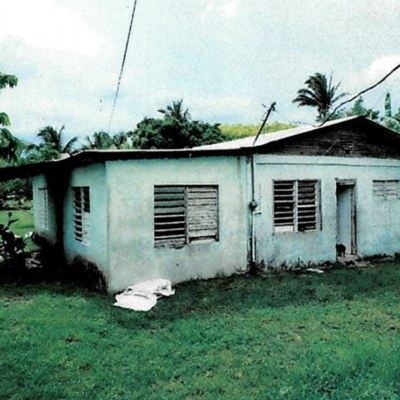
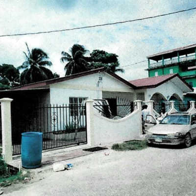
Block 4, Parcel 1123, Orange Walk District
Auction EndedLocation: Block 4, Parcel 1123, Orange Walk Town.
Description: On the property is a single storey building having 3 bedrooms, 2 bathrooms, living, kitchen, covered garage area, building has a floor area of 1213 sq.ft and shed 300 sq.ft. Land measures 446.67 sq.yds. Being the freehold interest.
-
Lot 295, Mile 16, Situated in Maxboro Area, Belize District – ASC.
Auction EndedLocation: Lot No. 295, Mile 16, situated in Maxboro area, Belize District.
Description: On the property is a single storey residence having four bedrooms, two and a half bathrooms, living, dining, office, kitchen, utility, garage and storeroom. The building is in good condition and has a total area of 3772 sq.ft and porch/deck of 576 sq.ft. being the freehold interest.
-
Parcel No. 816, Block 4, San Jose Palmar, Orange Walk District – LICU
Auction EndedProperty Details: ALL THAT piece or parcel of land being Parcel No. 816, Block 4, situated in the San Jose Palmar Registration Section, Orange Walk District containing 1.007 acres and held under a Land Certificate and being thereon, the freehold property of Pedro Eduardo Gonzalez surety for Susana Clarita Gonzalez.
Description: This parcel of land is an empty lot and is located in developing area.
-
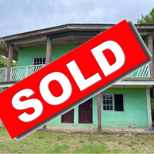
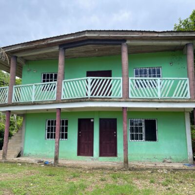
Lot 31, Block 42, Punta Gorda Town, Toledo District
Auction EndedLocation: Lot 31, Block 42, situated West of Punta Gorda Town, Toledo District.
Description: On the property is a two storey building with two, one bedroom, one bathroom apartments on the lower level, and a two bedroom, one bathroom apartment on the upper level, building has an area of 1535sq.ft and porch 514 sq.ft. The property is held in the Freehold Interest.

Related products
-
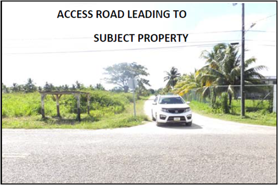
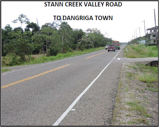
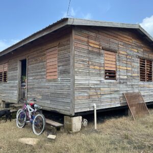
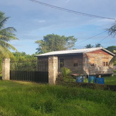
Lot 184, Hummingbird Community, Stann Creek District – ASC
Auction EndedProperty Description: The subject property is described as all that piece or parcel of land being Lot
#184, Hummingbird Community, Stann Creek District; together with all erections thereon. On the
property is bungalow residence having two bedrooms, one bathroom, living, dining and kitchen, for a total
area of 1191.04 sq.yds. The property is held in the Freehold Interest in the name of Pedro Guerra. -
FOR SALE PROPERTY REGISTRATION SECTION SOCIETY HALL, PARCEL: 3449, BLOCK: 24, CAYO DISTRICT
$460,000.00The subject property is described as all that piece or parcel of land being #3449, Block #24 in the Society Hall Registration Section of the Cayo District, Belize and being undeveloped land of 65.639 acres. It is better delineated and described as follows: On the south by an undeveloped acreage, on the west by an undeveloped acreage, on the north by a semi-cleared acreage with a residence and farm, and on the east by a gravel road, being a freehold property.